Hiking Trails in San Luis Obispo
Hit the Trail on the Best Hikes in SLO
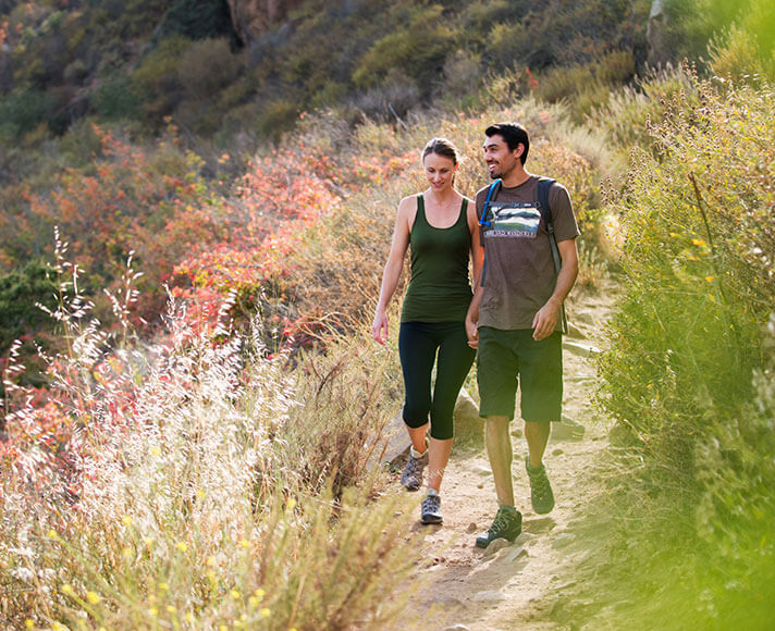
Looking for the best hiking trails in San Luis Obispo? You’re in the right place. From quick open space strolls near downtown to heart-pumping climbs with panoramic views, SLO makes it easy to find a trail that suits your mood, your timeline and your calves.
Below, we’ve rounded up some of the best hikes in San Luis Obispo County, including easy hikes for families, hilltop favorites, coastal paths, and iconic trails worth working into your trip. Pack water, wear sunscreen and get ready for breathtaking scenery in every direction.
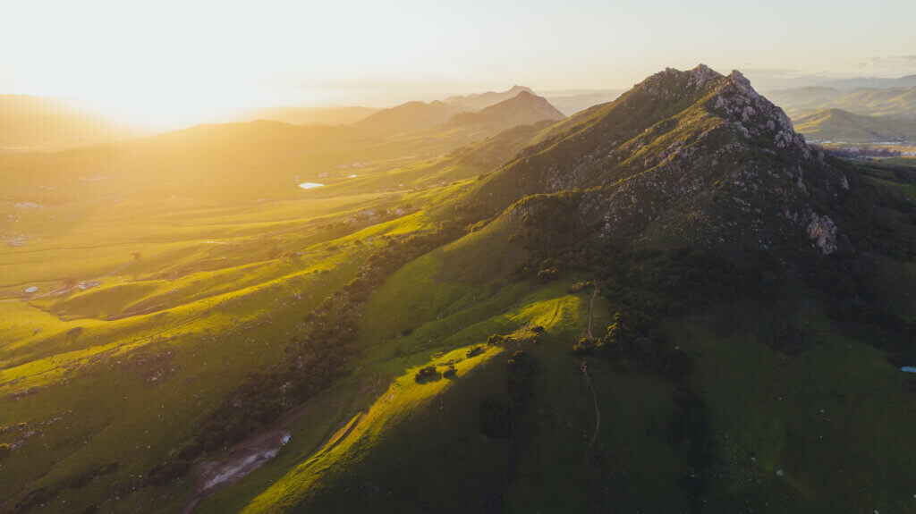
Panoramic Views: Plenty to Choose
Some hikes are about getting your steps in. These are about earning that big reveal. From city-view climbs to ridgeline routes, these hiking trails in San Luis Obispo deliver the kind of panoramic views you take your time to take in, and make you glad you held off on making dinner reservations.
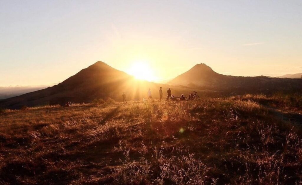
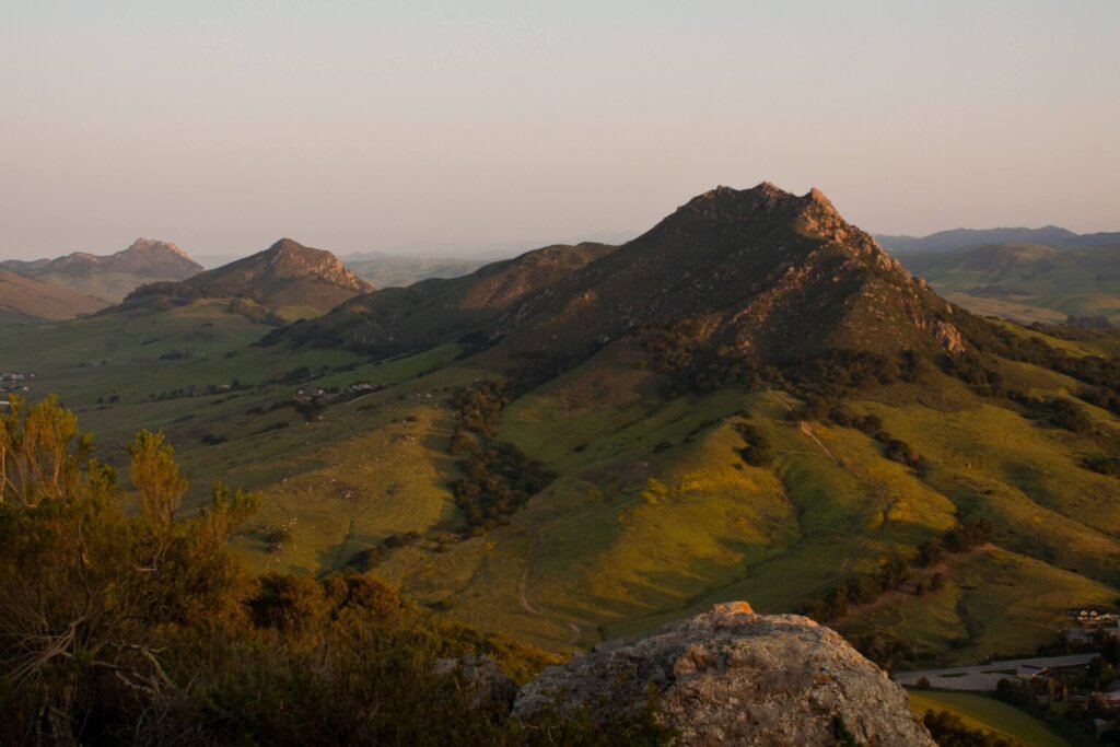
Cerro San Luis
“A terrific signature hike in SLO. There are a variety of options to get to the top, or you can circumnavigate the whole mountain. Terrific 360 views from the top!” – Chris L., Google
Beautiful oak trees, rock gardens and a sweeping view of the city make Cerro San Luis one of the best hikes in San Luis Obispo for locals and visitors alike. Locals also call it “Madonna Mountain,” and the trail network delivers that classic SLO payoff: climb a little, climb a lot or circle the mountain and let the panoramic views find you.
Routes range from short lower-mountain loops to longer summit and perimeter options, so you can choose anything from a quick leg-stretcher to a full SLO-view workout. It’s easily one of the best spots for sunrise or sunset in SLO, but the views are worth it just about any time of day.
Difficulty: Moderate to difficult
Distance: 1.5 to 5.8 miles round trip
Elevation gain: 250 to 1,233 feet
Dogs allowed: Leashed
Bikes allowed: Yes
Looking for more bike-friendly outdoor adventures? Check out our guide to biking trails in San Luis Obispo.
Reservoir Canyon
“The views are stunning throughout the hike. The elevation is pretty intense to climb at times, but well worth it when you reach the summit and experience the jaw-dropping site of San Luis Obispo and surrounding areas below.” – Anna L., Google
Looking for a hike with a bit of everything? Head for Bowden Ranch and Reservoir Canyon Open Space, where route options range from a short, shaded walk to a seasonal waterfall and nearby cave to a much steeper, rockier push to a ridge with 360º vistas over San Luis Obispo and the surrounding wilderness. The full route brings real elevation gain, so choose your distance before you start and save extra water for the climb.
Difficulty: Easy to difficult
Distance: 0.7 miles round trip to the waterfall; roughly 5.6 miles for the full Reservoir Canyon route
Elevation gain: About 50 feet to the waterfall; up to roughly 1,300 feet for summit routes
Dogs allowed: Leashed
Bikes allowed: No
Good to know: The waterfall is seasonal, so it does its best work after a nice rain.
Easy Hikes & Family-Friendly Open Space
Not every great hike in San Luis Obispo County has to be a summit mission. These easy hikes and neighborhood open space trails are ideal when you want fresh air, rewarding scenery and a little slice of the SLO Life without turning the whole day into leg day.
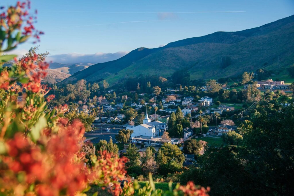
Terrace Hill Open Space
“As the name might suggest, the top of the hill is larger and completely flat with a few benches scattered around. Bring a blanket and watch the sunset for a beautiful ending to your day.” – Matthew M., Google
Take it nice and easy at Terrace Hill Open Space, one of our go-to vista points for San Luis Obispo sunrises and sunsets. This laid-back hike is perfect for the whole family, offering a gorgeous view of the city below with a flat plateau at the top that feels made for picnics, kite flying and lingering just a little longer.
Difficulty: Easy
Distance: 0.8 miles round trip
Elevation gain: 110 to 175 ft
Dogs allowed: Leashed
Bikes allowed: Yes
Good to know: The wide, flat, famously photogenic hilltop is popular for everything from engagement photos and graduation shoots to whole-family portrait sessions. Don’t be surprised if someone offers to snap your photo. (Feel free to return the favor.)
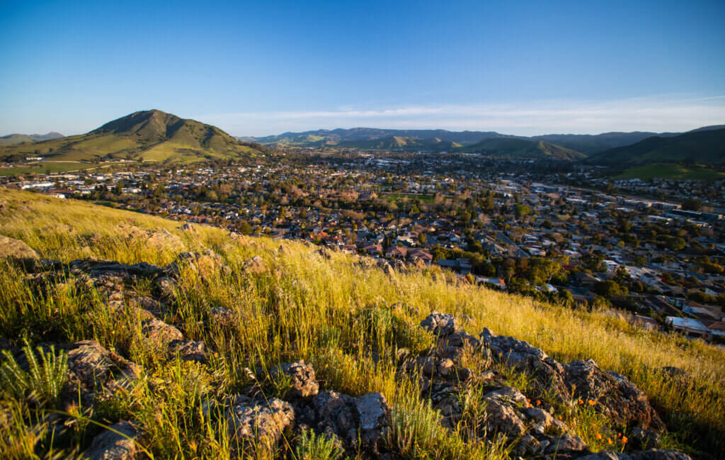
South Hills Open Space
“An easy hike with great views, beautiful rocks, and interesting plant and animal life.” – Ruth S., Google
Sometimes small investments lead to big payoffs. When it comes to South Hills Open Space, that means sweeping vistas at the end of a trail so easygoing and so close to downtown San Luis Obispo that locals call it the “lunch break hike.” This spot is perfect for a picnic with a view, a fresh-air reset or even a warm-up for the rest of your outdoor adventures.
Difficulty: Easy
Distance: 1.5 miles round trip
Elevation gain: About 450 feet
Dogs allowed: Leashed
Bikes allowed: Yes
Islay Hill
“Offers great views in all directions from the top, a cow statue for distinctly SLO flavored selfies, a geocache, and bowl at the top of the trail for any thirsty doggos.” – Zach R., Google
There’s plenty to point your camera at on top of Islay Hill, including Edna Valley vineyard vistas in every direction. But also the Instagram-famous Cow-on-a-Pole. (If you come down without a pic with it, did you ever really even go up?)
Choose this one for a huff here and a puff there on a slope that still feels approachable. On the way down, look out over the SLO wine country and plan where you’ll sip your reward later. Unspoken rule? First one to make a “hoof it” joke pays for the first tasting.
Difficulty: Moderate
Distance: 1.2 to 1.8 miles round trip, depending on the trailhead
Elevation gain: About 550 feet
Dogs allowed: Leashed
Bikes allowed: No
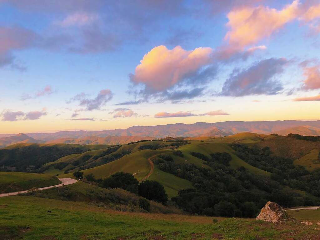
Righetti Hill Quarry Trail
“Great short trail to the top of Righetti Hill. Excellent views.” – Emily, Google
Formerly a private quarry and cattle ranch, 51-acre Righetti Hill Open Space is one of the newer additions to the city of San Luis Obispo’s open space network, and it already feels right at home. Set along the southeastern edge of town between parks, creeks and rolling hills, the Quarry Trail climbs to a not-too-tall summit with wide-open views toward downtown SLO, Edna Valley and the surrounding peaks. Perfect when you want a quieter neighborhood trail with enough uphill to feel earned, but not enough to rearrange your whole day.
Difficulty: Easy to moderate
Distance: 1.3 miles round trip
Elevation gain: 321 feet
Dogs allowed: Leashed
Bikes allowed: No
Coastal Vistas & Hidden Gems
For ocean air, coastal climbs and beautiful views beyond the city, these trails stretch the SLO hiking experience toward the coast. Think state park serenity, salty sea breezes and some of the best ocean vistas in San Luis Obispo County, all worth the short scenic drive.
Valencia Peak
“Hands down, my favorite hike of the central coast. Definitely at least an intermediate to advanced-ish hike but the summit isn’t as daunting as it looks. The switchbacks are set up quite nice. Amazing views the whole way!” Ashley N., Google
As one of the tallest mountains in Montaña de Oro State Park, Valencia Peak rises 1,347 feet above sea level and rewards the climb with sweeping coastal views of the Pacific Ocean, rugged sea cliffs and Morro Rock.
The route is shorter than other summit hikes, but the elevation gain is no joke, so bring water, wear sturdy shoes and expect your legs to join the conversation. By the way: don’t let a foggy morning cloud your day trip vision. Sometimes the best views and sunshine are waiting just above the marine layer.
Difficulty: Moderate to difficult
Distance: About 4 miles round trip
Elevation gain: Approximately 1,250 feet
Dogs allowed: No
Bikes allowed: No
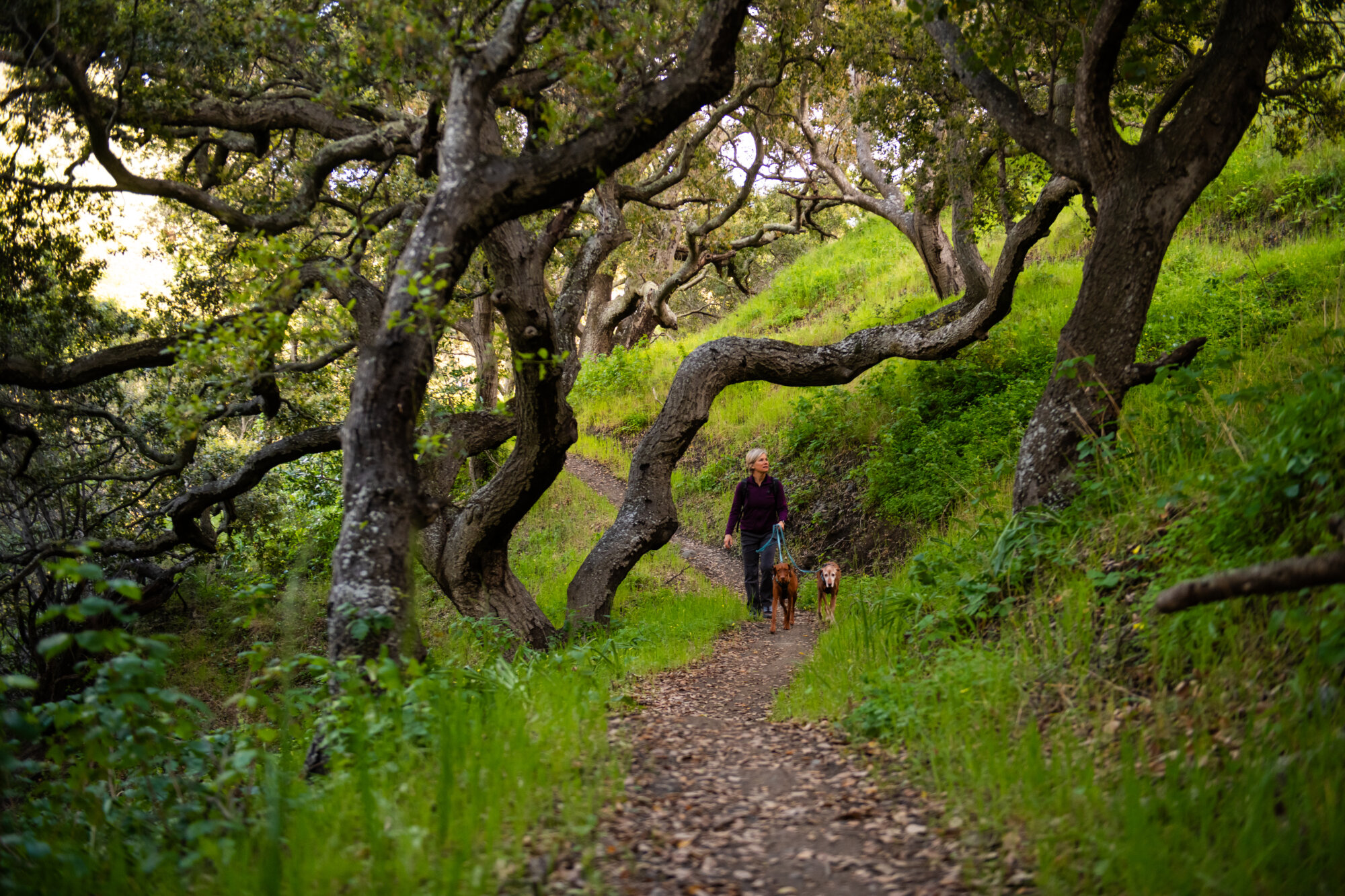
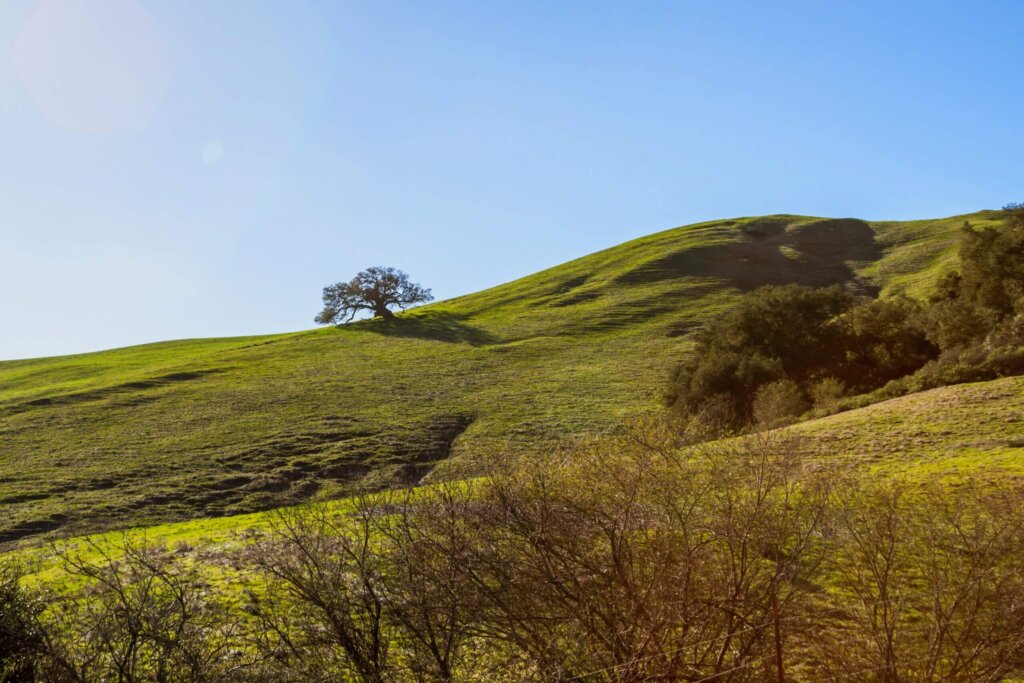
Irish Hills Natural Reserve
“The first part of the trail is like walking through magical woods, just beautiful! As you proceed upwards, there are many different trails to hike with most phenomenal views.” – Julie O., Google
See every side of SLO from Irish Hills Natural Reserve, a choose-your-own-distance trail network of grasslands, chaparral, shaded creekbeds and ridgelines. Depending on the route you choose, you can find views of Los Osos Valley, Cerro San Luis, Valencia Peak and even the Pacific Ocean.
Its proximity to the coast can make Irish Hills a smart choice when the inland sunshine is being too much of a good thing. Pick your route, pack layers and enjoy this near-coast jewel at whatever distance your day allows.
Difficulty: Easy to difficult
Distance: 3.0 to 8.4 miles round trip
Elevation gain: 500 to 1,535 feet
Dogs allowed: Leashed
Bikes allowed: Yes
Toro Creek Park
“What a fabulous find on our road trip. It was great to take our furry baby down to the beach and let him run and meet new friends. Was able to find a handful of sea glass during our walk.” Canada Kerri, Google
Toro Creek Park is a newer San Luis Obispo County open space between Morro Bay and Cayucos, with coastal views, paved paths and a perfect vantage of Morro Rock. It’s also a top pick for travelers with dogs, thanks to a beach just across the Pacific Coast Highway with a huge designated off-leash stretch of soft sand where pups can get in on the SLO Life, too.
The expansive inland trail system is still taking shape, with future routes planned through sweeping coastal hills and open grassland. In other words: this is both a beautiful place to visit now and a park-in-the-making to keep on your SLO radar.
Difficulty: Easy
Distance: 1.25 miles (for now)
Elevation gain: Barely noticeable
Dogs allowed: Leashed on trails; nearby designated beach areas allow off-leash access
Bikes allowed: Yes on the paved path
Good to know: Check current maps and posted guidance before heading inland, as new trail loops and staging areas are still rolling out.
Love hiking in San Luis Obispo? Love nature? See how we’re helping protect this beautiful place through our Sustainable SLO program, a tree-planting initiative powered by travelers like you.